Completed projects (Project 3)
Project Title :click
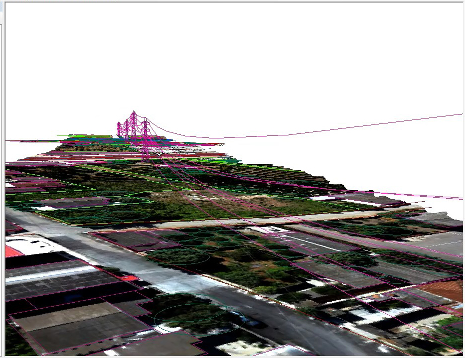
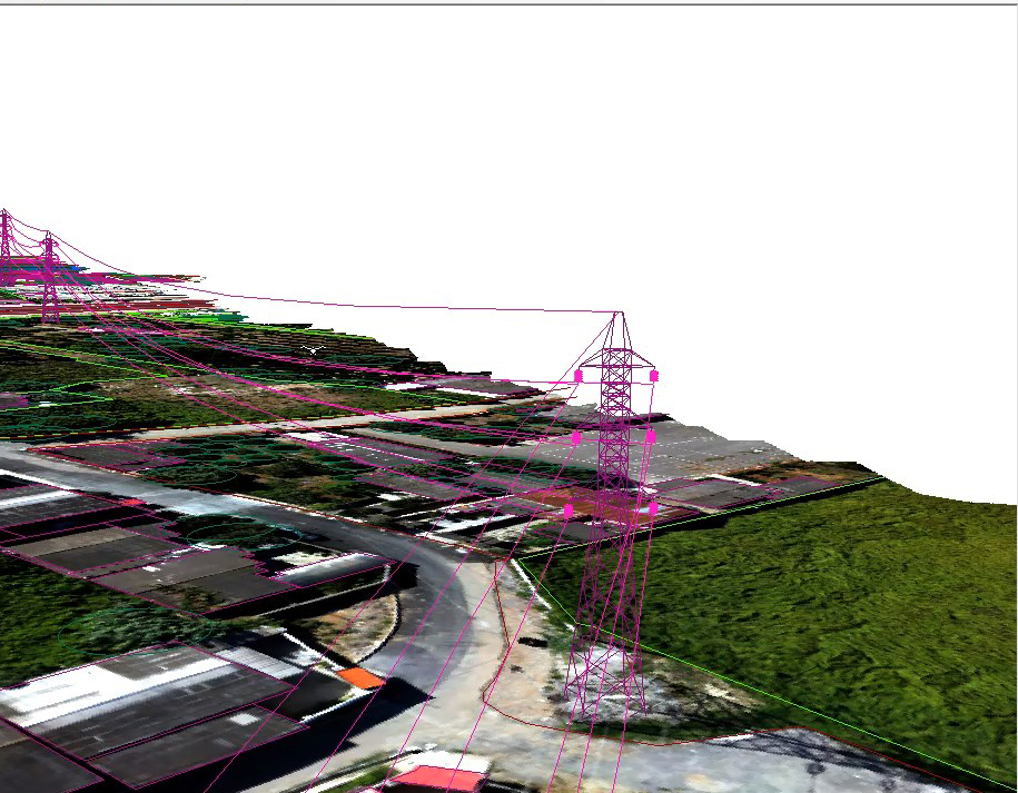
Aerial mapping, extraction of 3D model of lines
Project Description :click
Image processing to extract aerial map, plan and profile and three-dimensionalization of lines, identification of complications along the route and line privacy
applications :click
- Ability to measure cable height and find critical points
- The ability to measure the height of the tower
- The ability to identify towers at risk of drifting and...
- Topography of the tower
- Investigating the geometric condition of the tower at the location of identifying complications along the route