

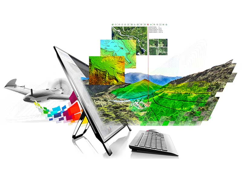
Photogrammetry UAV: The term UAV photogrammetry introduces a new measurement platform in photogrammetry, which is in two semi-modes
Automatic or fully automatic unmanned aerial vehicle remote control for aerial mapping purposes. This platform to a or
A combination of measurement systems in photogrammetry such as photo and video cameras, infrared and thermal cameras and lidar.
Air is equipped. Currently, the use of this system in developed countries such as America, Germany, Switzerland, Italy, France,
England and Australia are expanding, and in our country, the number of users is increasing day by day.
The emergence of advanced image processing algorithms has made it possible to extract valuable geometric information from non-metric images.
which is a leap forward compared to Reich’s classic photogrammetry methods. These pictures can be taken by a bird
small above the sky with a relatively low height.
بدون دیدگاه